Application Description
Discover the ease of managing KML/KMZ/GPX files with MAPinr, a robust GIS tool that offers comprehensive features for measuring, GPS logging, and WMS support. Our app also allows you to use offline maps, ensuring you're never lost even without an internet connection.
Thank you for choosing MAPinr. We understand the challenges posed by the rapid evolution of Android versions, yet we remain committed to keeping this project alive. Our goal is to provide a secure, privacy-focused, and affordable app that meets your needs. Please note that while Google requires a minimum Android version, we continue to support older versions (below Android 14) with downloads available on our website.
Do you want to efficiently manage your points of interest or perhaps create a visual map of your adventures? MAPinr is the simple, ad-free Android app you need. It's perfect for professionals as well as enthusiasts in hiking, cycling, running, skiing, and more.
We value your feedback and ideas on how to improve MAPinr. Please reach out to us at [email protected] with your thoughts and suggestions. We appreciate your patience and understanding as we work within our limited resources to address software bugs and implement new features.
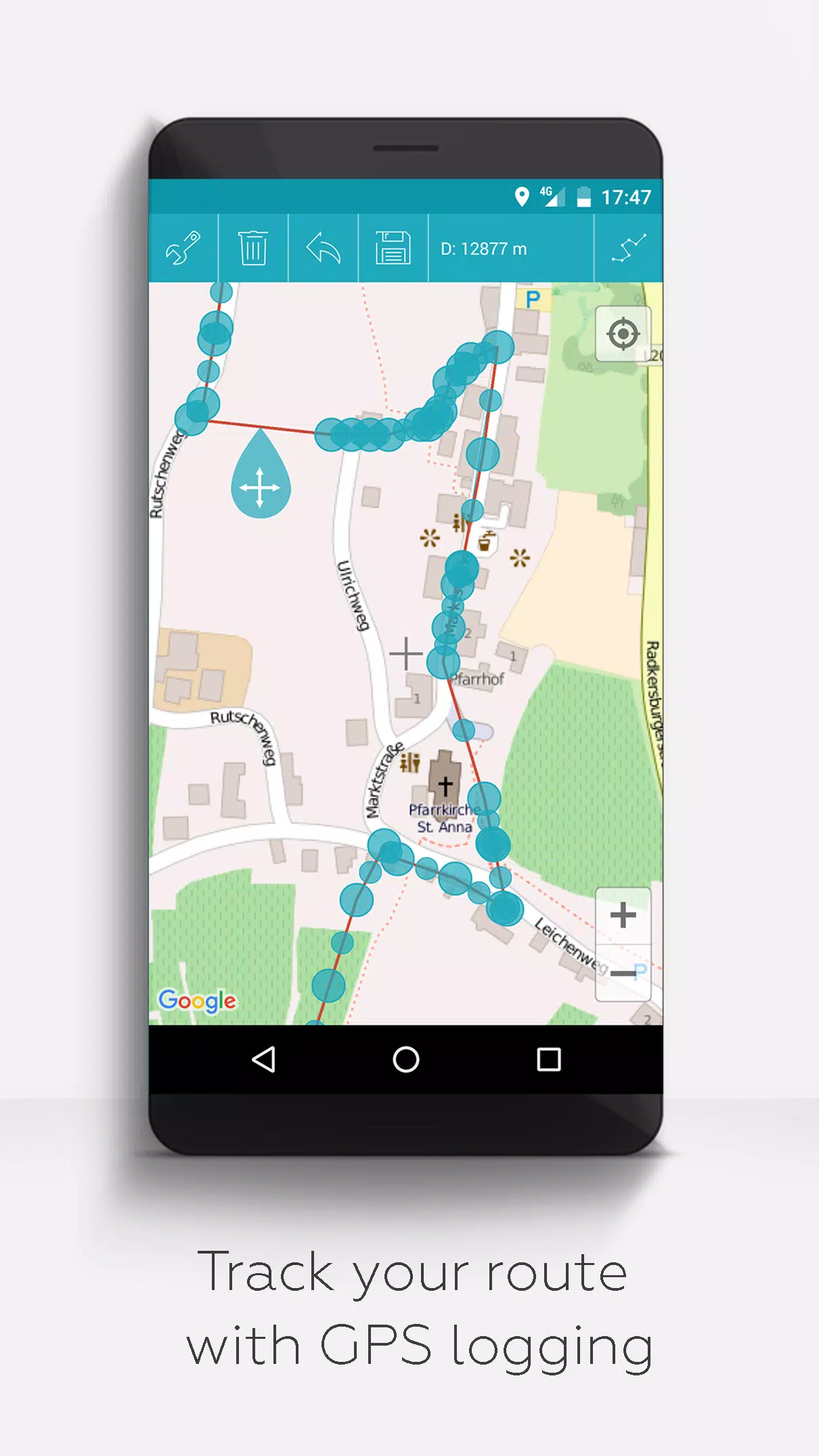
MAPinr offers a wide range of functionalities:
- Ad-free experience - Enjoy using the app without any interruptions from advertisements.
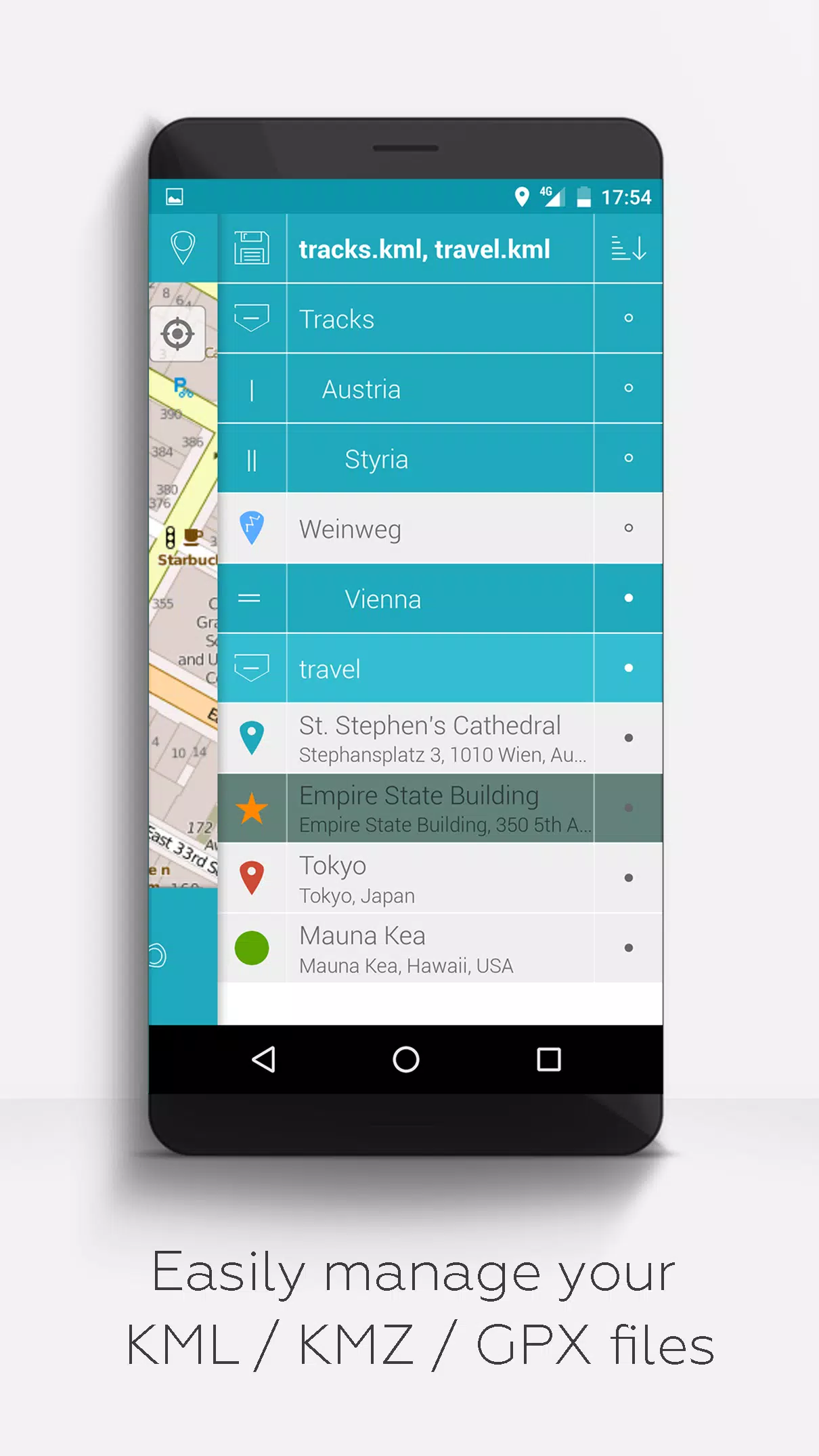
- Hierarchical folder structure - Easily manage multiple KML/KMZ/GPX files.
- KML/KMZ file management - Create, load, edit, save, import, export, and share your files seamlessly.
- Waypoints, lines/tracks, and polygons - Create, edit, save, import, export, and share these elements with ease.
- Photomaps - Add pictures to your waypoints to create personalized photomaps.
- Versatile map display - View your waypoints, lines/tracks, and polygons on various maps, including Maps, Satellite, Hybrid, OpenStreetMap, Opentopomap, and Opencyclemap.
- Coordinate sharing - Share the coordinates of your waypoints with others.
- Customization - Colorize your waypoints, lines/tracks, and polygons individually.
- File compatibility - Open exported KML/KMZ files in other applications.
- Search capabilities - Search by name, address, and coordinates to find what you need quickly.
- Location sharing - Let your friends know your exact location effortlessly.
- Multi-file display - Display multiple KML/KMZ/GPX files simultaneously for comprehensive views.
- File merging - Merge KML/KMZ files to streamline your data.
- Cloud integration - Keep your data synced and accessible across devices.
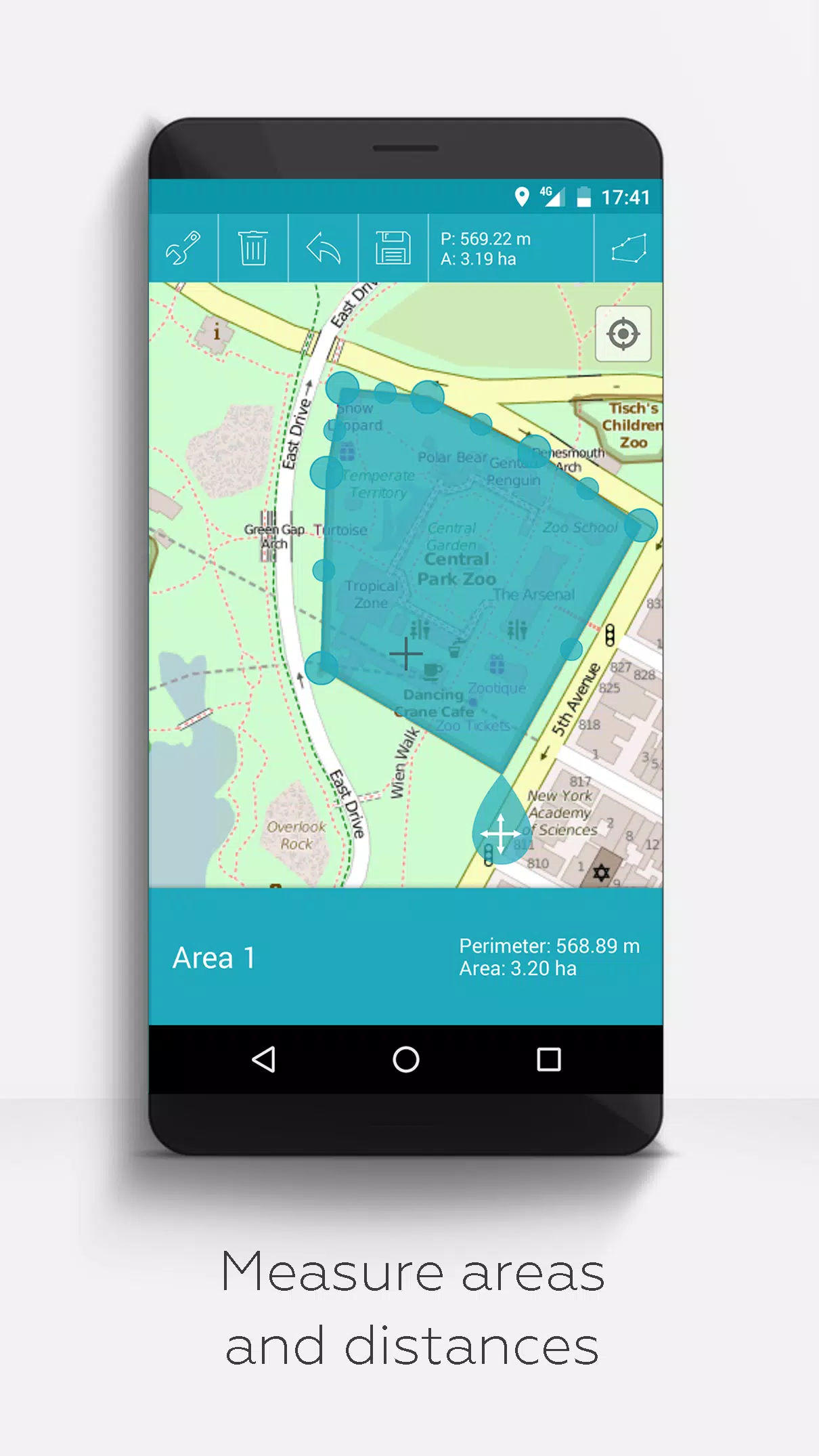
- Measurement tools - Measure distances and areas directly on your map.
- Multilingual support - Currently available in English, Spanish, Lithuanian, and Polish.
Extended features, available for free with donations or a LinkedIn like, can be activated in the app's settings:
- Offline maps - Download OpenStreetMap maps for use without an internet connection.
- GPX viewer - Display GPX files within the app.
- Web Map Service (WMS) - Access and display arbitrary map data, such as Opendata from www.data.gov.
- Custom metadata - Create custom metadata to enhance your mapping experience.
- Custom icons - Upload and use your own icons for a personalized touch.
- GPS track recording - Record your GPS tracks for later use or sharing.
Unlike other apps, MAPinr respects your privacy and does not collect or sell your personal data. Your donations are a voluntary contribution to support our non-profit work, helping us to continue providing this valuable tool.
Travel & Local


 Apps like MAPinr - KML/KMZ/OFFLINE/GIS