Application Description
Embark on your adventures with confidence using Geo Tracker, the premier GPS tracking app designed for those who love to explore the outdoors or travel extensively. Whether you're navigating unfamiliar territories, sharing your journeys with friends, or simply keeping a record of your explorations, Geo Tracker is your go-to solution. Compatible with both Open Street Maps and Google, this app is perfect for anyone seeking a reliable GPS tracker.
With Geo Tracker, you can:
- Ensure you find your way back in unfamiliar areas without getting lost;
- Share your routes with friends, making it easy to collaborate on adventures;
- Import routes from GPX, KML, or KMZ files, allowing you to follow paths others have taken;
- Mark significant or interesting points along your journey;
- Locate specific points on the map if you know their coordinates;
- Showcase colorful screenshots of your achievements on social networks.
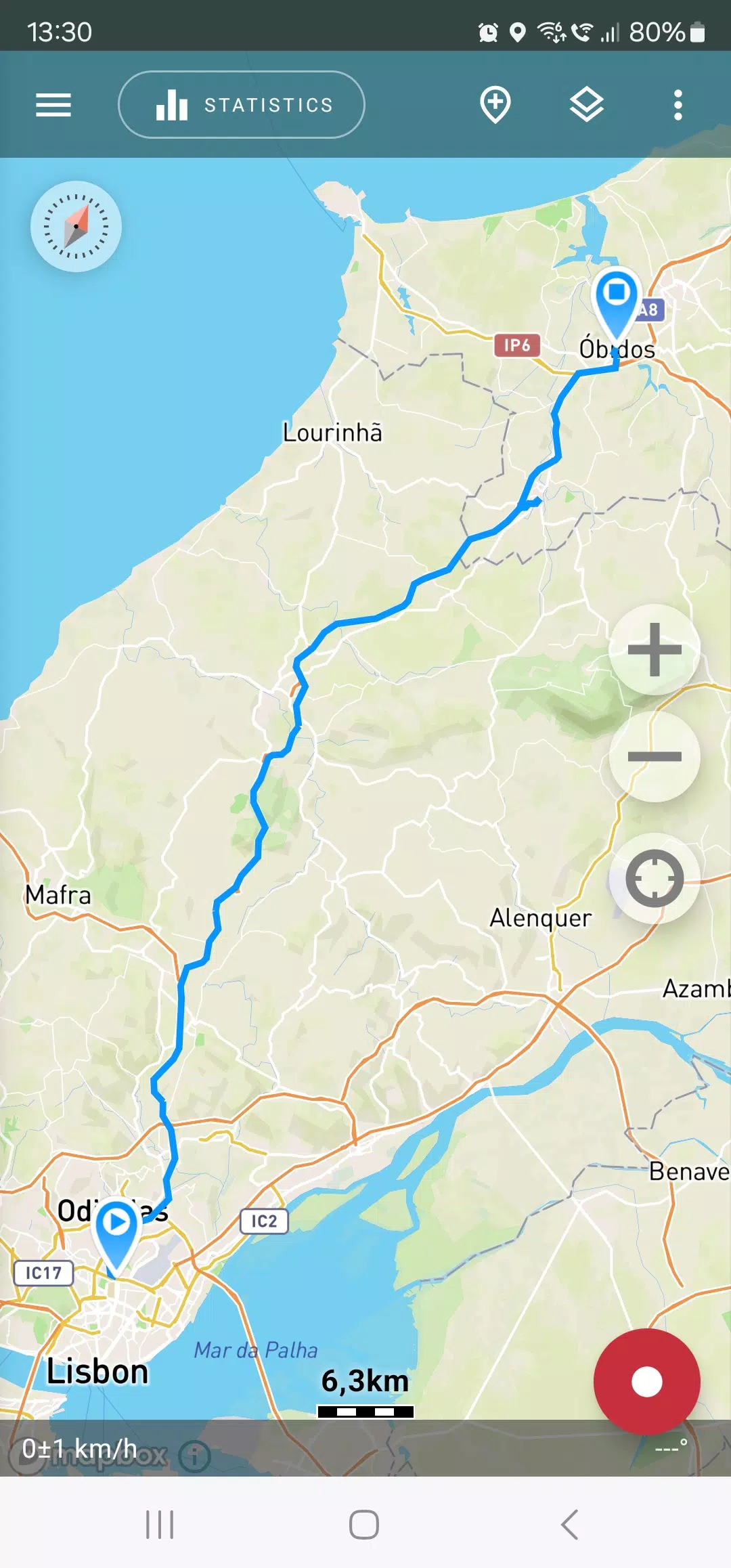
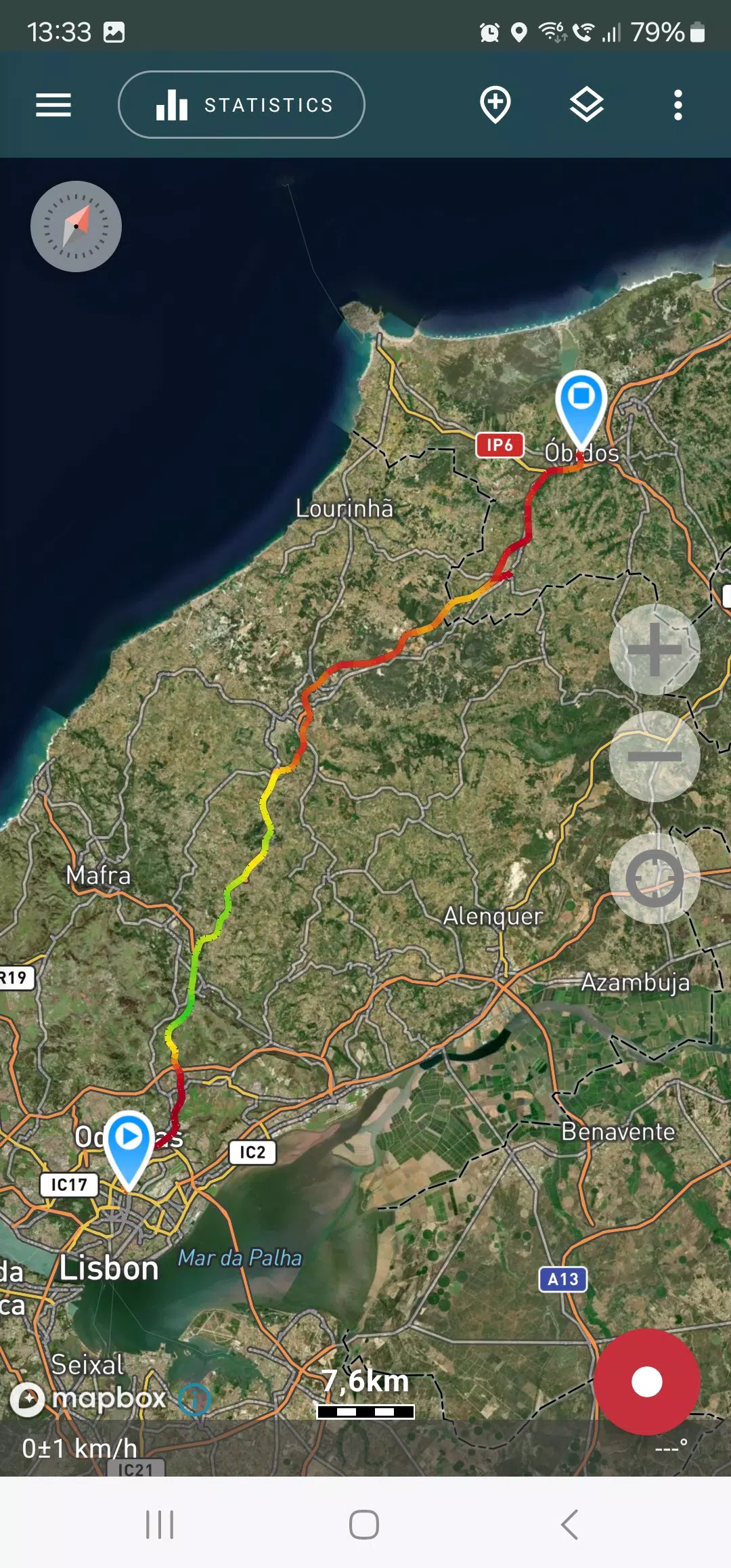
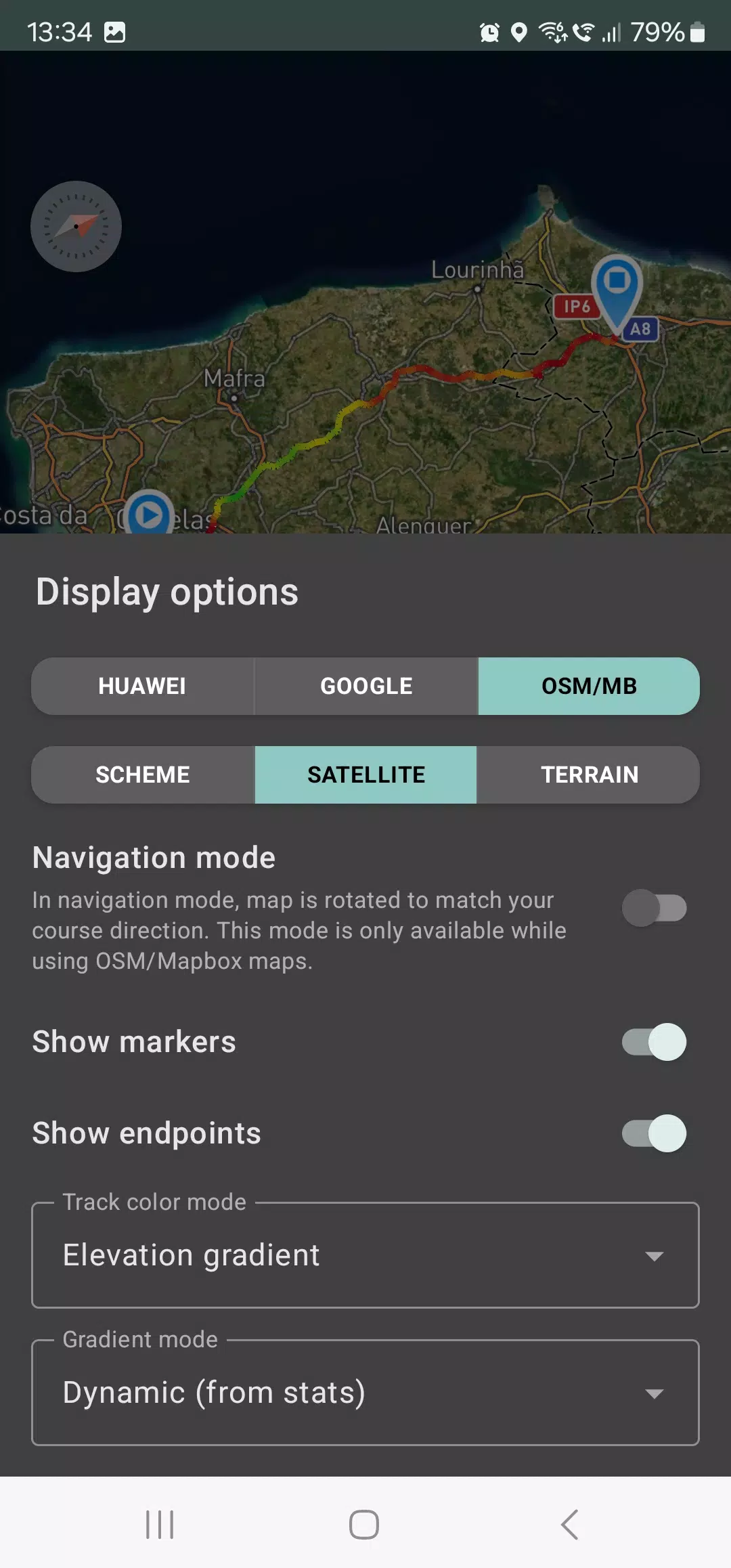
The app allows you to view your tracks and the surrounding area using detailed maps from OSM, Google, or satellite images from Google or Mapbox. These map areas are cached on your device, enabling offline access, especially effective with OSM maps and Mapbox's satellite imagery. To record and analyze your track statistics, only a GPS signal is required; internet access is needed only for downloading map images.
Enhance your driving experience with the navigation mode, where the map automatically rotates to match your direction of travel, simplifying your journey. Geo Tracker can also record your tracks in the background, with optimized power consumption allowing for up to a full day of recording on a single charge. You can further extend battery life with the economy mode, available in the app settings.
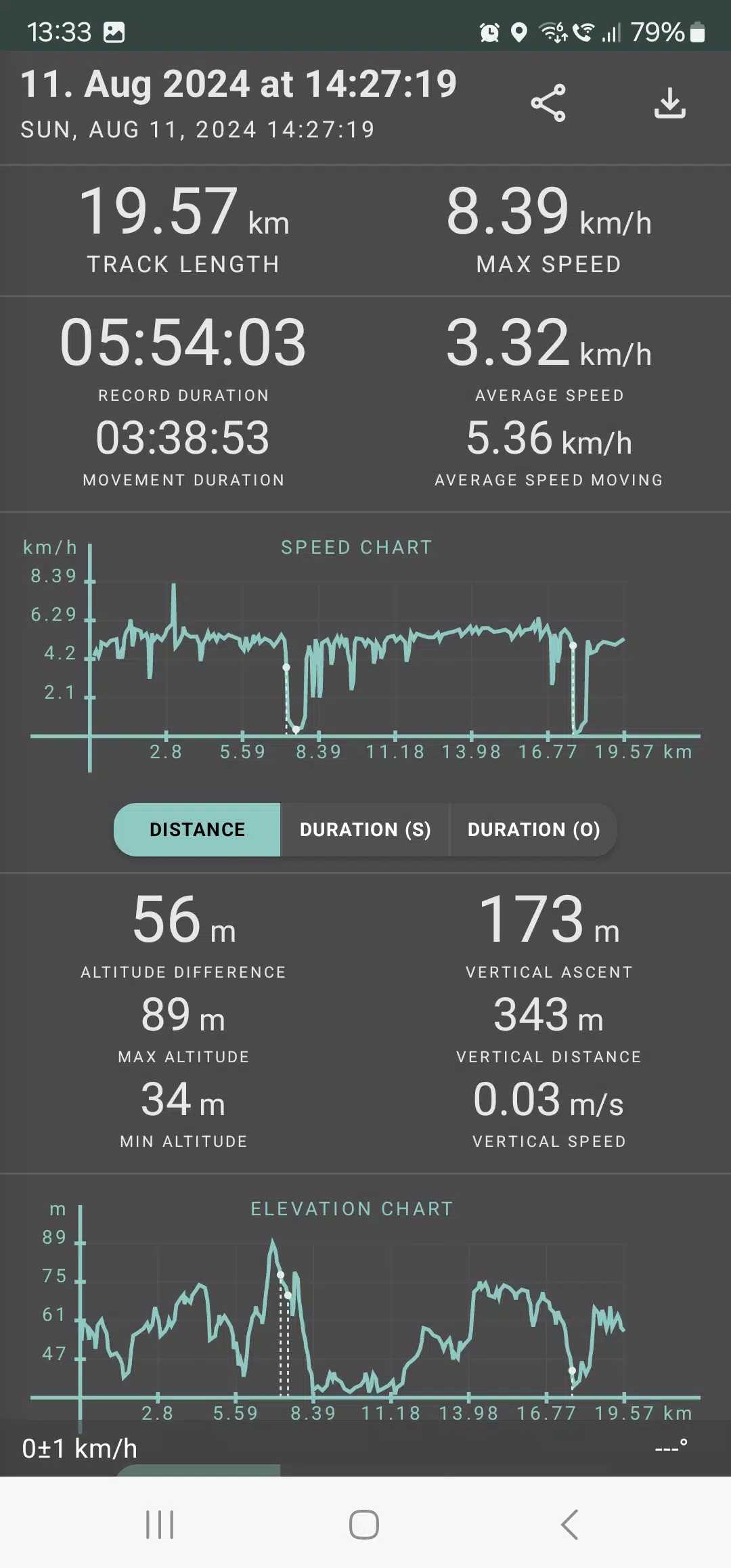
Geo Tracker provides comprehensive statistics on your trips, including:
- Distance traveled and total recording time;
- Maximum and average speed along the track;
- Time spent in motion and average speed during movement;
- Minimum and maximum altitude, along with the altitude difference;
- Vertical distance, ascent, and vertical speed;
- Minimum, maximum, and average slope.
Additionally, detailed charts of speed and elevation data are available for a deeper analysis of your tracks. Your recorded tracks can be saved in GPX, KML, and KMZ formats, compatible with popular applications like Google Earth and Ozi Explorer. All data is stored locally on your device, ensuring your privacy as no information is sent to external servers.
Geo Tracker operates without ads and does not exploit your personal data. Support the ongoing development of the app by making a voluntary donation through the application.
To ensure a smooth GPS tracking experience, consider the following tips to address common issues:
- Allow some time for the GPS signal to be acquired when starting a new track.
- Restart your smartphone and ensure a clear view of the sky, free from obstructions like tall buildings or dense forests.
- Be aware that GPS reception can be affected by weather, season, satellite positioning, and areas with poor coverage.
- Enable "Location" services in your phone's settings.
- Set your phone to automatically update "Date & Time" and "Time Zone" to avoid delays in GPS signal acquisition due to incorrect time settings.
- Ensure airplane mode is turned off in your phone settings.
If these tips do not resolve your issues, consider uninstalling and reinstalling the app. Note that Google Maps enhances its location data with information from surrounding WLAN and mobile networks, which can be a useful point of comparison.
For more information and solutions to common problems, visit the Geo Tracker FAQ page at https://geo-tracker.org/faq/?lang=en.
Travel & Local

 Apps like Geo Tracker - GPS tracker